Ogilby Map 1677
I used the phrase "north of the Thames" above because, in 1550, a ward called "Bridge Without" was created in Southwark. This ward existed until 1978 when it was
merged with Bridge (Within) which brought the total number of wards to its present 25. While the total number has been at 25 or 26 since the year 1394, their
boundaries and names have changed through time with the two most recent of these changes being in 2003 and 2013.
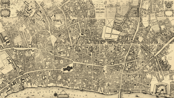
To accurately identify the names and boundaries of the wards at the time the trade tokens were issued, I turned to the Ogilby and Morgan map of
1677 titled "A Large and Accurate Map of the City of London, Ichnographically Describing all the Streets, Lanes, Alleys, Courts, Yards, Churches,
Halls, and Houses, &c. Actually Surveyed and Delineated, By John Ogilby, Esq; His Majesties Cosmographer" This map, published after Ogilby's death in
1676, shows London in great detail after the Great Fire and was compiled at the terminus of the token period. Individual buildings are surveyed, making this
work invaluable in studies of the layout of 17th Century London.
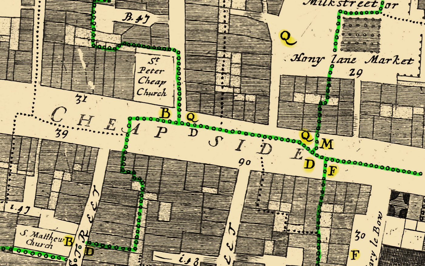
The Ogilby map of 1677 has numerous boundary lines on it delineating the various wards and parishes. An example of the ward lines are depicted in green
on the excerpt map shown here below which represents an area east of St Paul's Cathedral. The highlighted letters ("B", "Q", "M", "D", and "F") are an index to the wards.
For example, the highlighted "Q" indicates that that area is in the Cripplegate Ward.
Ogilby Map 1677 Showing Ward Boundaries
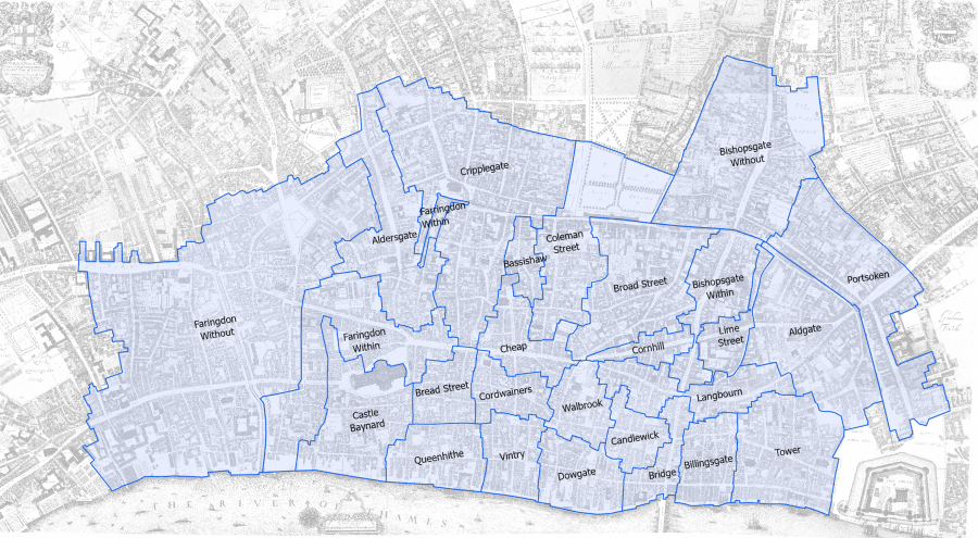
Once the Ogilby map sheets were seamed together and georeferenced (see About the Maps) the lines representing the wards were digitized in
ArcPro to create a shapefile. Great care was taken to digitize these as accurately as possible but it must be noted that the locations of the
circles on Ogilby's map do not necessarily represent the exact spot on the ground for the boundary.
Any correction made to the positioning of the image of the map, brought upon by adding a new reference point to increase the accuracy of the map's geographic location,
required adjusting the polygon of one or more wards to ensure they matched the map still. At the same time, adjustments would also be made to the
digitized streets.
Many times the circles are shifted in one direction or the other so as to be distinguishable on the map and to not obscure other features which may actually lie on
the boundary line. At times it is difficult to determine if the line is meant to be the edge or the center of a street. In cases of ambiguity of intent on the
part of Ogilby, the boundary line was digitized through the center of the circles. The digitized wards are shown overlain on Ogilby's map below.
Digitized Wards as they Appeared in 1677
Wards of London in the 17th Century
Like today, the City of London north of the Thames in the 17th century was divided into 25 different wards which were self-governing districts of the
larger city. The term "ward" is still used in the United States, too, especially in terms of voting, though the self-governing status is largely
non-existent. New Orleans in the state of Louisiana is an example where, though no officials have represented them since 1912, the city has held onto
the tradition of a ward.
 On the right side of the map, in the middle of Cheapside, is the intersection of four wards "Q", "M", "D", and "F." These represent the Cripplegate, Cheap, Bread
Street, and Cordwainers wards, respectively. Today, the ward of Cripplegate does not extend nearly so far south as it did during the seventeenth century.
On the right side of the map, in the middle of Cheapside, is the intersection of four wards "Q", "M", "D", and "F." These represent the Cripplegate, Cheap, Bread
Street, and Cordwainers wards, respectively. Today, the ward of Cripplegate does not extend nearly so far south as it did during the seventeenth century.